Post by Creepy on May 19, 2014 4:29:14 GMT -4
I saw some 'things' in the woods around there that made me think the area was not always wilderness. There seemed to be old homesteads and flat areas with rock borders and fruit trees among the pines. Some grassy areas in the woods.
So I got to looking closer, rooting around the intarweb, and found some cool images on google maps. Apparently there are falls 100m up from the bridge.
nswaterfalls.blogspot.ca/2012/08/pockwock-river-falls-pockwock-halifax.html
Then I found reference to the old road being called Camptown Road, it was part of the original road to Annapolis Royal from Halifax, it was built by the English! Now we are getting into the early history of Nova Scotia, cool!
TRAIL DESCRIPTION: walk down this old road approximately 1km to the bridge over the Pockwock River. Head upstream from the bridge between 50-100m to the falls. There is no trail but bushwhacking along the bank isnt too difficult. The west side (right hand side facing upstream) has remains visible of old mills and dams.
Furthermore, heading downstream from the bridge, about 100m, along the trail there, will bring you to the remains of Wrights Mill, an old sawmill and dam, both of which are in complete disrepair. Camptown Road was part of the Old Annapolis Road that was constructed in the 1800s by the British as an overland route from Halifax to Annapolis Royal.
Go back and cross the bridge and turn left down a trail along the river bank. After about 100 m you will find the splintered remains of an old sawmill. I remember this building about 35 years ago when it was sound and had a large horizontal single cylinder gasoline engine down below. The dam, now in shambles, was sound then but there was no sign of a water wheel.
Go back to the bridge and explore the west side of the river from the bridge to the falls. There is evidence of other older mills and dams.
Check out this rock wall!
www.google.ca/maps/@44.757309,-63.868589,3a,75y,90t/data=!3m5!1e2!3m3!1s51587655!2e1!3e10
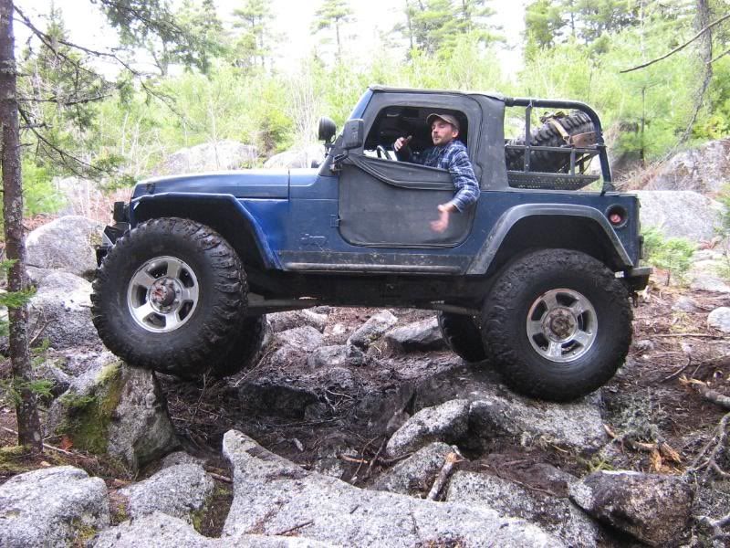
Wright's Lake is what the river drains into....why is it called that? Wright's Mill! The pic of my buggy is very near the old mill site I think! I'm going back there with the Jeep and looking around more.
2.bp.blogspot.com/-ywJj5VDeqZU/UDOSAqlm-hI/AAAAAAAAClg/kt50i1sYOHE/s1600/pockwock+map.jpg
Parking for the Camptown Road is N 44'45.385' W 063'51.365' The road is an old road that eventually connects with the Old Annapolis Road built by the British in the 1800's.according to the locals there were a number of camps on the road hence the name. Part of the road was 'upgraded' for logging. There are the remnants of Wright's saw mill by Wright's Lake. They tell me many a fish has been taken out of Wright's Lake. The cache is in an oasis surrounded by clear cut logging and environmental abuse. Travel 1 km down the road to the bridge, follow up river about 50m to the waterfall. The cache is a welding rod container in a large rock overlooking waterfall.When placed contained,a light stick,emergency candle,survival whistle & match container, magnifying glass, N.s. Playing cards, hand warmer, combo lock,valantine pin. $2.00 tim's FTF and Lucky Penny TB.
Wiki of Old Annapolis Road.
en.wikipedia.org/wiki/Old_Annapolis_Road,_Nova_Scotia
Road building commenced in 1784. After a few miles had been constructed at the Western (Annapolis Royal) end of the road, work ceased. In 1816 construction resumed, with portions of the road slightly relocated to provide access of land considered more suitable for settlement. Considerable progress was made in the West, with the road reaching Sherbrooke - today known as New Ross[5] - approximately halfway along the intended route. East of Sherbrooke, the hostile terrain proved too difficult and while the route was cleared to Halifax, construction halted.[4]
Some construction was completed at the Halifax end which began at the Hammonds Plains Road and which led to the Bedford Highway near Kearney Lake. Settlements by Black Refugees from the War of 1812 were successful along the first stretch of the Annapolis Road from Halifax which later became known as the Pockwock Road. West of Hammonds Plains, the road became known as the Camptown Road and connected a number of mills and lumber camps as far as Rafter Lake. However further west, beyond Card Lake, the road was never completed or settled.[6]
The road today:
Halifax end of the Old Annapolis Road near Hammonds Plains
Sections of the road are in use as parts of the road from Annapolis Royal to New Ross, which follows approximately the same route as that surveyed in 1784.[7] Sections of the Eastern construction still exist as the alignment of several local road segments such as the Pockwock Road a well as logging roads and trails. One section of the road near Halifax was developed by the Bowater Mersey Paper company as the Old Annapolis Road Hiking Trail[8] and has been popular with hikers, although it was abandoned by the paper company in 2012.[9]
No friggin' shit! It crosses the Nictaux River, the 'other' awesome rockcrawling zone we use.
upload.wikimedia.org/wikipedia/commons/f/fa/Old_Annapolis_Road_Map.png
Ok, Ok, that's enough for now. History overload.
So I got to looking closer, rooting around the intarweb, and found some cool images on google maps. Apparently there are falls 100m up from the bridge.
nswaterfalls.blogspot.ca/2012/08/pockwock-river-falls-pockwock-halifax.html
Then I found reference to the old road being called Camptown Road, it was part of the original road to Annapolis Royal from Halifax, it was built by the English! Now we are getting into the early history of Nova Scotia, cool!
TRAIL DESCRIPTION: walk down this old road approximately 1km to the bridge over the Pockwock River. Head upstream from the bridge between 50-100m to the falls. There is no trail but bushwhacking along the bank isnt too difficult. The west side (right hand side facing upstream) has remains visible of old mills and dams.
Furthermore, heading downstream from the bridge, about 100m, along the trail there, will bring you to the remains of Wrights Mill, an old sawmill and dam, both of which are in complete disrepair. Camptown Road was part of the Old Annapolis Road that was constructed in the 1800s by the British as an overland route from Halifax to Annapolis Royal.
Go back and cross the bridge and turn left down a trail along the river bank. After about 100 m you will find the splintered remains of an old sawmill. I remember this building about 35 years ago when it was sound and had a large horizontal single cylinder gasoline engine down below. The dam, now in shambles, was sound then but there was no sign of a water wheel.
Go back to the bridge and explore the west side of the river from the bridge to the falls. There is evidence of other older mills and dams.
Check out this rock wall!
www.google.ca/maps/@44.757309,-63.868589,3a,75y,90t/data=!3m5!1e2!3m3!1s51587655!2e1!3e10
Wright's Lake is what the river drains into....why is it called that? Wright's Mill! The pic of my buggy is very near the old mill site I think! I'm going back there with the Jeep and looking around more.
2.bp.blogspot.com/-ywJj5VDeqZU/UDOSAqlm-hI/AAAAAAAAClg/kt50i1sYOHE/s1600/pockwock+map.jpg
Parking for the Camptown Road is N 44'45.385' W 063'51.365' The road is an old road that eventually connects with the Old Annapolis Road built by the British in the 1800's.according to the locals there were a number of camps on the road hence the name. Part of the road was 'upgraded' for logging. There are the remnants of Wright's saw mill by Wright's Lake. They tell me many a fish has been taken out of Wright's Lake. The cache is in an oasis surrounded by clear cut logging and environmental abuse. Travel 1 km down the road to the bridge, follow up river about 50m to the waterfall. The cache is a welding rod container in a large rock overlooking waterfall.When placed contained,a light stick,emergency candle,survival whistle & match container, magnifying glass, N.s. Playing cards, hand warmer, combo lock,valantine pin. $2.00 tim's FTF and Lucky Penny TB.
Wiki of Old Annapolis Road.
en.wikipedia.org/wiki/Old_Annapolis_Road,_Nova_Scotia
Road building commenced in 1784. After a few miles had been constructed at the Western (Annapolis Royal) end of the road, work ceased. In 1816 construction resumed, with portions of the road slightly relocated to provide access of land considered more suitable for settlement. Considerable progress was made in the West, with the road reaching Sherbrooke - today known as New Ross[5] - approximately halfway along the intended route. East of Sherbrooke, the hostile terrain proved too difficult and while the route was cleared to Halifax, construction halted.[4]
Some construction was completed at the Halifax end which began at the Hammonds Plains Road and which led to the Bedford Highway near Kearney Lake. Settlements by Black Refugees from the War of 1812 were successful along the first stretch of the Annapolis Road from Halifax which later became known as the Pockwock Road. West of Hammonds Plains, the road became known as the Camptown Road and connected a number of mills and lumber camps as far as Rafter Lake. However further west, beyond Card Lake, the road was never completed or settled.[6]
The road today:
Halifax end of the Old Annapolis Road near Hammonds Plains
Sections of the road are in use as parts of the road from Annapolis Royal to New Ross, which follows approximately the same route as that surveyed in 1784.[7] Sections of the Eastern construction still exist as the alignment of several local road segments such as the Pockwock Road a well as logging roads and trails. One section of the road near Halifax was developed by the Bowater Mersey Paper company as the Old Annapolis Road Hiking Trail[8] and has been popular with hikers, although it was abandoned by the paper company in 2012.[9]
No friggin' shit! It crosses the Nictaux River, the 'other' awesome rockcrawling zone we use.
upload.wikimedia.org/wikipedia/commons/f/fa/Old_Annapolis_Road_Map.png
Ok, Ok, that's enough for now. History overload.