Post by Creepy on Jul 28, 2009 9:38:30 GMT -4
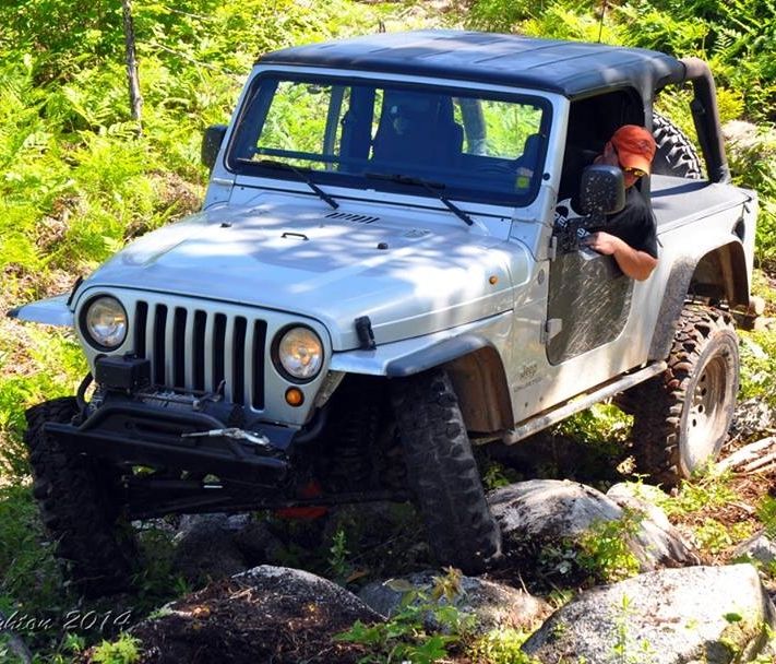
Well Capers, here is a nice run for yas to try out. i made it alone at dusk in a stocker.  The trails are public right of ways, you are free to travel them.
Simply cross the Seal Island Bridge, turn left into the campground, and head for the Scout camp. Keep driving and taking the forks that keep you next to the water. (keep on the more travelled roads, don't head uphill into wilderness)
Heavy rains have washed out parts of the road, there are a couple of switchbacks where you could fall into a ravine if you aren't careful.
There are rocks in the road that have rolled down from the mountain that can take out oil pans, watch out for them.
Lots of trees bending over, but any major stuff has been chainsawed and cleared.
The road is unmaintained, DOT used to run a grader thru once a year, but no more. It is becoming a trail. A nice long trail!
When you get to the powerlines coming from Boulandrie Island, you can hill climb up the powerlines and run a grown in trail along the top of Kelly's mountain. (I didn't go to the end, it exits in South Haven at the circa 1885 little white church. Could be impassable, i don't know)
So once done frigging around at the hill climb, stay on the original trail and you come out in Big Harbour, and paved road. It exits on the 105.
Or then try and take Old Big Harbour road to Plaister Mines off the old Baddeck highway. Very grown in, but killer veiws of the plaster cliff faces. Watch out for sinkholes from mines if you go in the woods. I saw one about 50' across and just as deep with water in the bottom. You would be hard pressed to climb out of it, and you would be injured if you fell in. ie: broken leg at bottom of a pit. not good!
There is potential to be able to travel from Seal Island to Baddeck along undeveloped land on the shores and mountains of beautiful Cape Breton. quite an opportunity, it will wind up being developed at some point. land prices are very high in the surrounding communities.
tons of pioneer history, these are the original roads our Scottish ancestors used between Baddeck, New Harris, New Campbellton, St Annes. 1735-1900
I even found an old stone foundation in one spot...would have been early 1800's it was made. Just sitting in the woods, surrounded by mature oaks.
 The trails are public right of ways, you are free to travel them.
Simply cross the Seal Island Bridge, turn left into the campground, and head for the Scout camp. Keep driving and taking the forks that keep you next to the water. (keep on the more travelled roads, don't head uphill into wilderness)
Heavy rains have washed out parts of the road, there are a couple of switchbacks where you could fall into a ravine if you aren't careful.
There are rocks in the road that have rolled down from the mountain that can take out oil pans, watch out for them.
Lots of trees bending over, but any major stuff has been chainsawed and cleared.
The road is unmaintained, DOT used to run a grader thru once a year, but no more. It is becoming a trail. A nice long trail!
When you get to the powerlines coming from Boulandrie Island, you can hill climb up the powerlines and run a grown in trail along the top of Kelly's mountain. (I didn't go to the end, it exits in South Haven at the circa 1885 little white church. Could be impassable, i don't know)
So once done frigging around at the hill climb, stay on the original trail and you come out in Big Harbour, and paved road. It exits on the 105.
Or then try and take Old Big Harbour road to Plaister Mines off the old Baddeck highway. Very grown in, but killer veiws of the plaster cliff faces. Watch out for sinkholes from mines if you go in the woods. I saw one about 50' across and just as deep with water in the bottom. You would be hard pressed to climb out of it, and you would be injured if you fell in. ie: broken leg at bottom of a pit. not good!

There is potential to be able to travel from Seal Island to Baddeck along undeveloped land on the shores and mountains of beautiful Cape Breton. quite an opportunity, it will wind up being developed at some point. land prices are very high in the surrounding communities.
tons of pioneer history, these are the original roads our Scottish ancestors used between Baddeck, New Harris, New Campbellton, St Annes. 1735-1900
I even found an old stone foundation in one spot...would have been early 1800's it was made. Just sitting in the woods, surrounded by mature oaks.